Images of Richmond
 While we had a short stay in Richmond, we took a wonderful bus tour of the area that really gave us a great orientation to the city. Richmond was a focal point in both the Revolutionary and Civil Wars. In 1861, it became the capital of the Confederacy, the political, industrial and transportation hub of the south.
 The photo above is of the Richmond Skyline across the James River. Richmond is the only city that can claim rapids in an urban setting. We were told that kayaking is an avid sport in Richmond with many office workers taking to the rapids on their lunch hours. We were at this point after the lunch hour so we did not see these activities on the river.
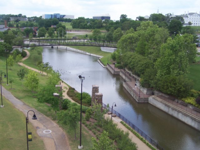
 I commented on the rapids because Richmond also have beautiful canals to bypass the river, as this photo shows. It was George Washington, who designed the canal system with the desire to reach the Ohio River for expansion and trade routes to the West. The canals never reached the Ohio but the remnants are now part of the Richmond riverwalk. In the upper left corner, are the Civil War's Tredegar Iron Works that provided armaments for the Confederacy. Above the Iron Works is the white rectangular building, which is the World War II memorial.
 Richmond's Fan District is filled with 1890 Victorian homes and stuctures, along Monument Avenue. This photo is of the Jeb Stuart monument. Jeb was a West Point-trained calvary man and legendary Confederate hero, who fought in many significant Civil War battles and died near Richmond at the end of the war at the age of 31.
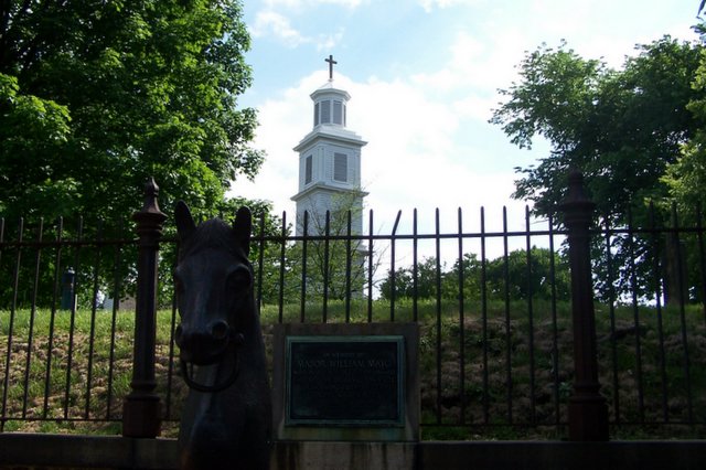
This is a photo of St. John's Church, where in 1775, in the presence of Washington, Jefferson, and other delegates to the Virginia Convention, Patrick Henry delivered his address, "Give me liberty or give me death!"
After the tour, we took a drive over 12 miles of the 80 mile Civil War battlefield tour. Richmond is a beautiful area and hillier as we move away from the coast.
posted by Nancy Karasek @ 7:33 PM
0 comments
![]()
![]()

0 Comments:
Post a Comment
<< Home